Search the Community
Showing results for tags 'network map'.
Found 1 result
-
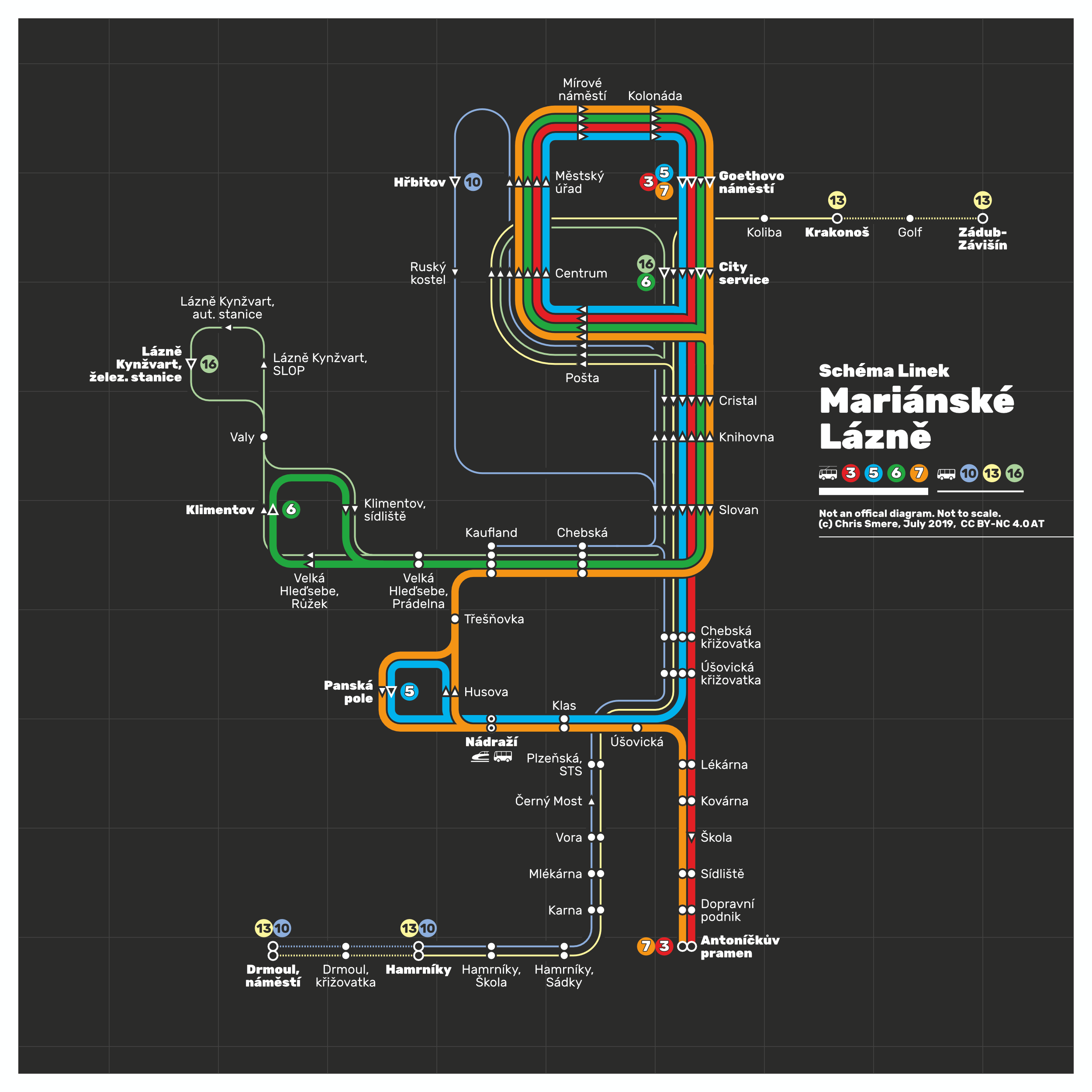
 Hi - it's me again :-) I do transit maps (diagrams) for fun in my spare time to relax. Here is another one I was working on the past days and have updated just now: It's my totally unofficial transit map showing the complete bus and trolleybus network of city of Mariánské Lázně (Marienbad), Czech Rebuplic. The trolleybus replaced the streetcar network in the early 1950s. Feedback, corrections, input is always appreciated. Have a nice Thursday night =) Chris
- 14 replies
-
- 8
-

-
- bus
- trolleybus
- (and 5 more)