alx_Serif
-
Posts
5 -
Joined
-
Last visited
Everything posted by alx_Serif
-
Too slow when working with many anchor points
alx_Serif replied to Steff's topic in V1 Bugs found on macOS
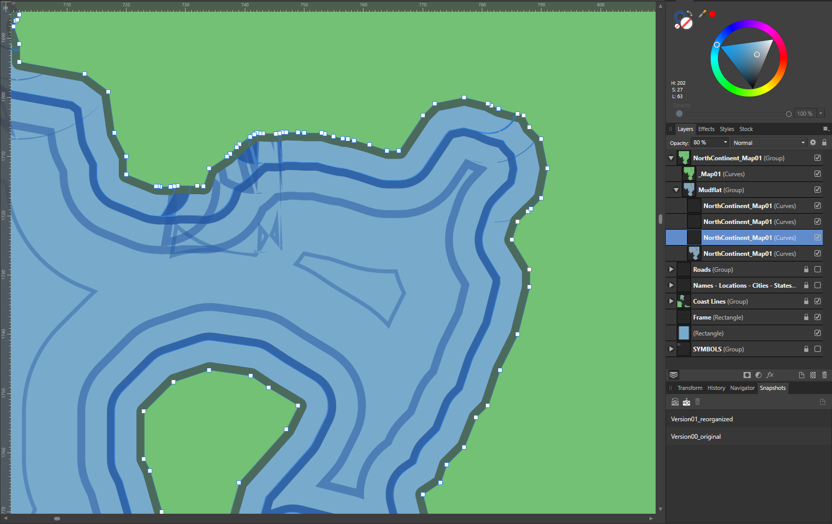
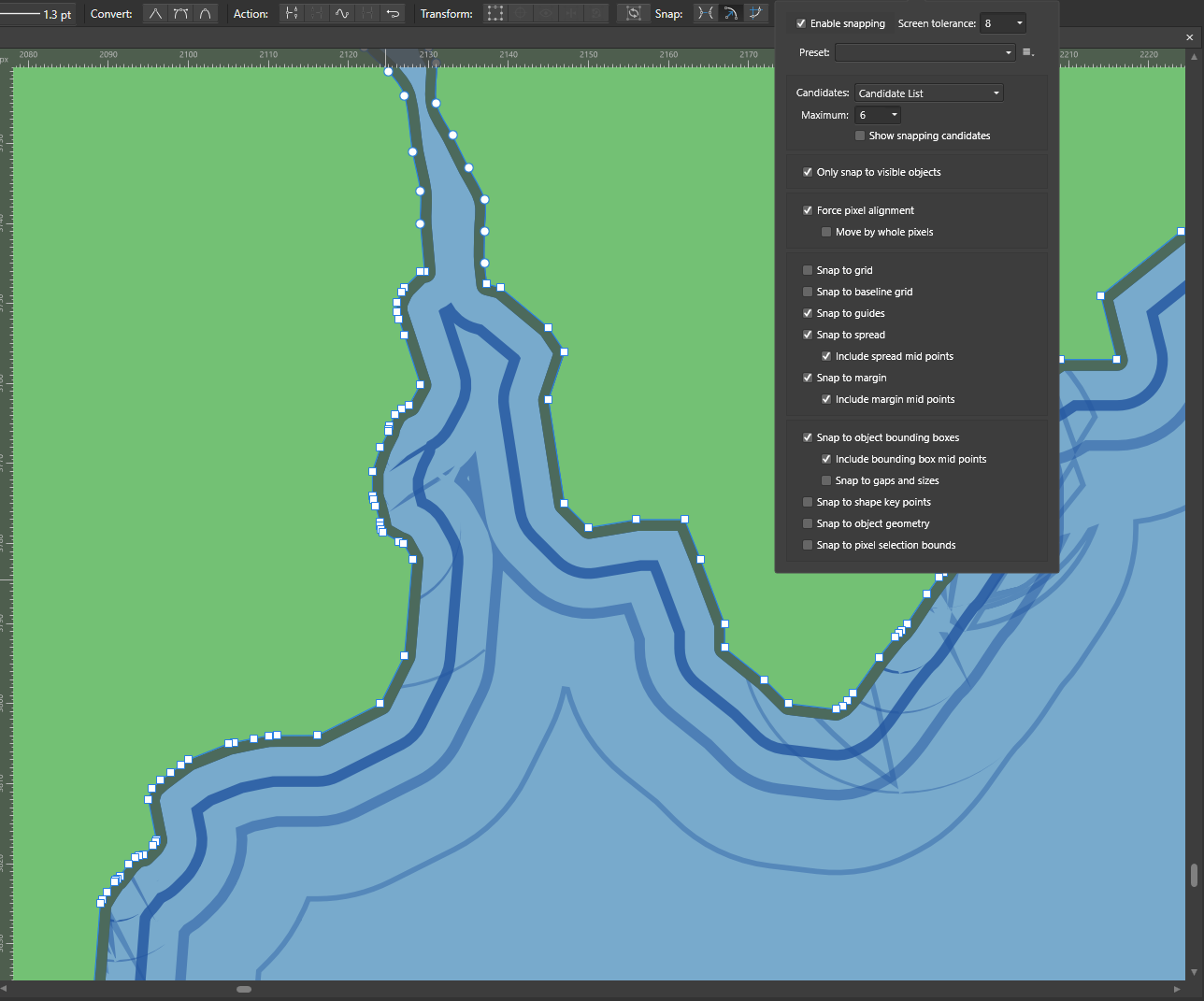
Hi. Here's a DROP BOX LINK. A few points: - Although this is already a *huge* file (150 MB), it's actually only parts of the entire project. I simplified the main file to see if by doing so I could help with responsiveness. It's a tad faster, but barely. The main project is four times larger and destined to become even more complicated, with roads, tens and tens of city/location symbols, labels, rivers, mountains, etc. And yes, this is a vector map through and through -- no rasterized elements here. - Responsiveness is becoming an overall issue, but is most acute when I try to deal with some of the visual artifacts created by the new Contour Tool. When you have many anchor points (see below), you get weird little "knots of lines" along some sections of the coast. To get rid of them, I have to select the right anchor points and delete them. The deletion is fast enough for the base map, but super slow for the following "contoured maps" (the highlighted layer in the picture below). - I should add that I didn't place the anchor points where they appear in the picture below: they clumped together the more I was adding anchor points elsewhere on the map. - And here are my basic PC specs, in case you need 'em:
-
Too slow when working with many anchor points
alx_Serif replied to Steff's topic in V1 Bugs found on macOS
So this is the problem I'm having as well: too many anchor points, which has forced me from working as the program has become unresponsive. And my "Snap to Gaps and Sizes" option is unchecked. Any work around?
-
I'm still experimenting and seeing what works best for my needs, so this is indeed a good option. Thank you for the suggestion.
-
Thank you for this. Yes, it does work well. However, my comment still holds -- although I now realize it wasn't clear enough. The issue with this solution is that the text or label needs to be grouped with the object or objects it's going to partially hide. This goes against most map creation workflows though. When producing maps, as you surely know, it's indeed a very good idea to keep similar elements together. So, all roads are put together, and all coast lines are grouped with other similar coast lines. The same is done with text labels, and other elements. This lets one change the appearance of all of those elements at once, easily and quickly. The work is thus more consistent and the chances of making mistakes is vastly reduced. The workaround suggested above forces map creators to do away with this long established workflow, as it forces them to isolate certain labels and group them with the objects they need to partially cover. It's fine for one or two labels, sort of, but it becomes a real issue when one has to deal with tens of labels, all having to be grouped with other elements of the map, like, parts of a coast line, or a river, or a road, or a building and a road, etc. The project's organization takes a real beating, which makes mistakes more likely. It would be better to achieve the effect seen above *without* having to group the text with the object(s) it's hiding.
-
This solution doesn't have the flexibility offered by the solution offered on that cartography blog (linked in the original question). The issue here is that the text becomes anchored to the object it's place above. As a result, moving the text after grouping it with the object becomes a problem -- not to mention when there are multiple objects beneath the text. Still, this is a nice workaround.