Search the Community
Showing results for tags 'subway map'.
Found 1 result
-
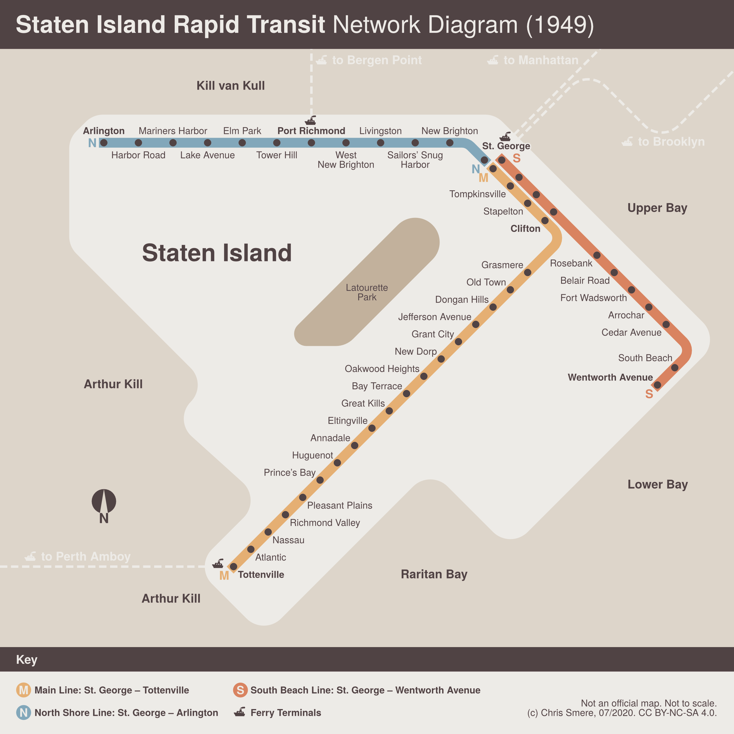
 Hey ho! Vignelli inspired transit diagram showing the Staten Island Rapid Transit lines in 1949. The North and South branches closed in 1953. Added ferry connections that run back then. It's anachronistic as the design is from the 1970s conceived by Vignelli for the MTA transit diagram. My approach is abstract and geography is only partially accurate. Have fun - constructive feedback is appreciated. Chris 🙂
-
- 3
-

-
- sirt
- transit diagram
- (and 7 more)