

Daniel Finch
-
Posts
45 -
Joined
Posts posted by Daniel Finch
-
-
54 minutes ago, firstdefence said:
Displace won't work with this file, using the mesh warp via the Photo Persona would be a better option.

Aye! This looks promising. Thank you!
-
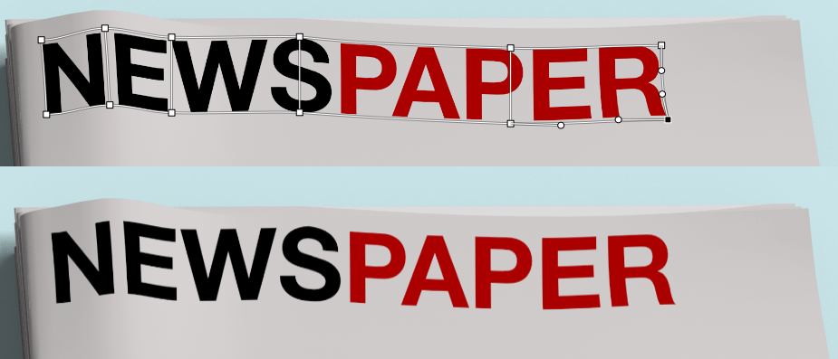
Hello, just wondering if it's possible to get the text to "bend" around the creases of the newspaper if that makes sense? See attached file.
-
1 hour ago, MEB said:
Hi @Mark Clifford,
Where are this supposed to be used? on the web, printed? Have you considered other formats if applicable? SVG for web for example?Twitter, Facebook and on my own website. I have tried SVG but that's not compatible for social media..
-
9 minutes ago, BofG said:
Make it larger so the desired "zoomed in" view is the 100% size and to see the whole thing you have to zoom out.
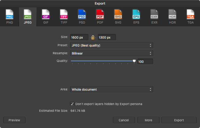
Do you mean the whole document? If so, I have a separate document for that purpose. This is UK Wide.
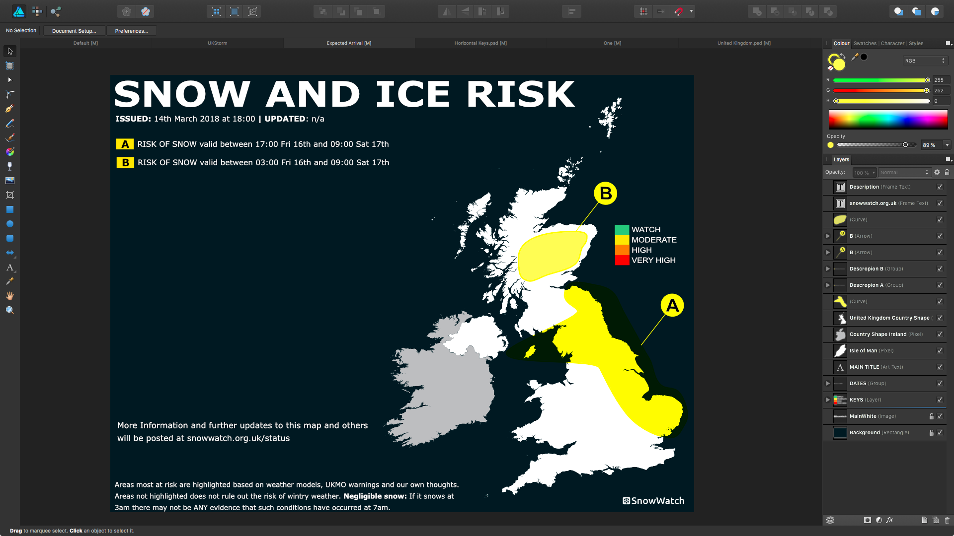
12 minutes ago, Old Bruce said:The thing is too tiny. The text for the labels, green ones, is less than 4 pixels in height. No way that is going to be legible.
I appreciate that I may need to make the A roads (green) and Motorways (blue) icons bigger but that doesn't help with the map and town names being blurred when zoomed into an exported .jpg file.
-
I want to improve the resolution of this graphic when zoomed into. Map, place names and road names all blurred currently. Any suggestions?
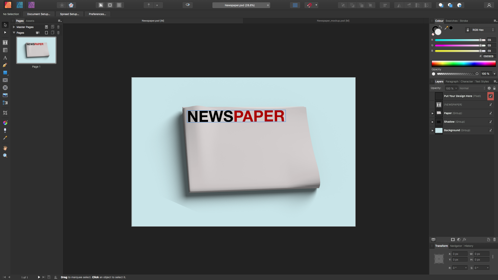
Export Settings:
Example:
Download template: 2021:22 Full.afdesign
-
36 minutes ago, walt.farrell said:
Many times "this problem" is a user error involving miss-positioned layers or layers with the wrong DPI, and fixing those resolves the problem.
Have you verified that you are actually experiencing one of the bugs, and not one of the user errors?
Thanks for your reply. After playing around I discovered Layer > Geometry > Merge Curves which solved my problem. I was wanting to merge several map layers together and rasterise quality was awful.
-
Hello. I'm still getting this problem. Any update?
-
Just now, walt.farrell said:
You could draw three rectangles, each of a different color, arranged side-by-side, and moved underneath the other elements in the layer stack.
Yes, I did think of that myself but wondered if there was an even way of doing it as drawing rectangles individually may not come out as even as say drawing a grid etc.
-
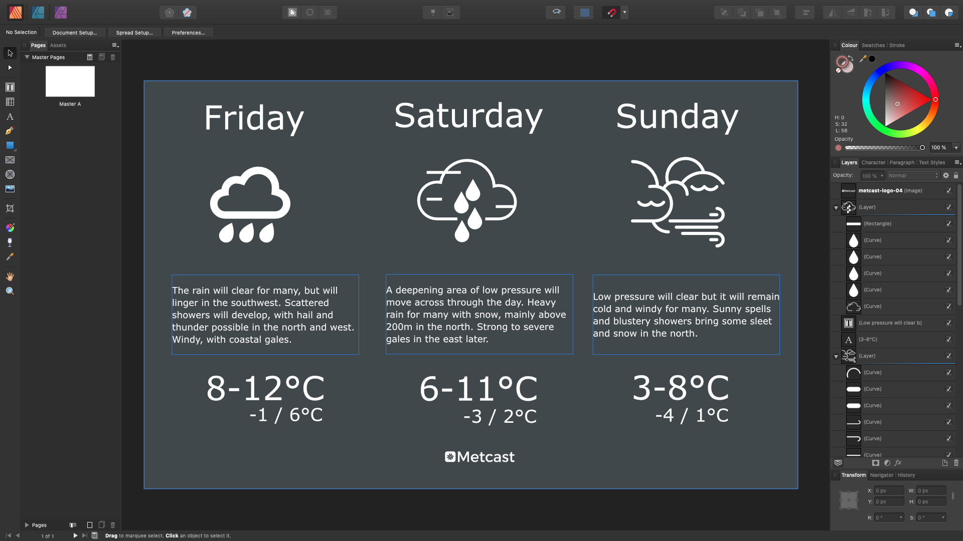
I need help with splitting it into three with different background colours.
I have already tried text frame but you can only set one background colour for it.
Thanks in advance.

-
Managed to do it with your help! Thanks guys.
-
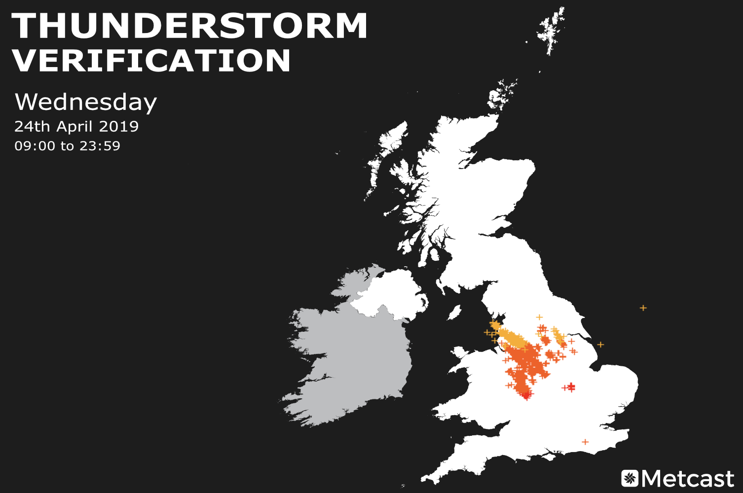
Hello,
I'd like to mask out this image so that the yellow, orange and red icons are only showing--no background. Please watch this video and help me as I'm a newbie.
-
On 2/22/2017 at 2:52 PM, nammr said:
My way
1. Select your layers ->
2. Right click ->
3. Geometry ->
4. Add
Well, this is certainly a good work around however what happens if you want one element a different colour?
-
Hello @JFisher
The version I have installed is 1.7.0.145 and there's no auto updates available but I will manual install now.
-
-
-
-
4 minutes ago, αℓƒяє∂ said:
Boolean ‘Add’ them instead.
What does that mean? The map is made up of loads of different parts.
-
Second time lucky?
-
2 minutes ago, walt.farrell said:
How about grouping all of the shapes?
That doesn't work if I draw a shape over all three separate map parts as only one of them will be covered by the shape I draw.
5 minutes ago, firstdefence said:Could you not just select all 3 separate parts and use export (Selection without background) or (With Background) to suit, as a PNG file and import that in back into the document. then overlay whatever shapes you need to. You could use the blend modes to colour just the white areas
I'm not sure you understand what I'm trying to do, despite my best efforts to explain it
-
I've got myself really confused. Probably because I haven't played with Affinity Designer for a while.
In the example below you can see that the "A" shape is snapped onto the map. The map itself is one image. In the video, as I explained the map is not one image but in three separate parts. What I want to do is make those 3 separate parts one so that I can snap shapes to the map as shown below. Hope that makes more sense.
-
Please watch. See below.
-
That's very frustrating! Thank you for your help.
-
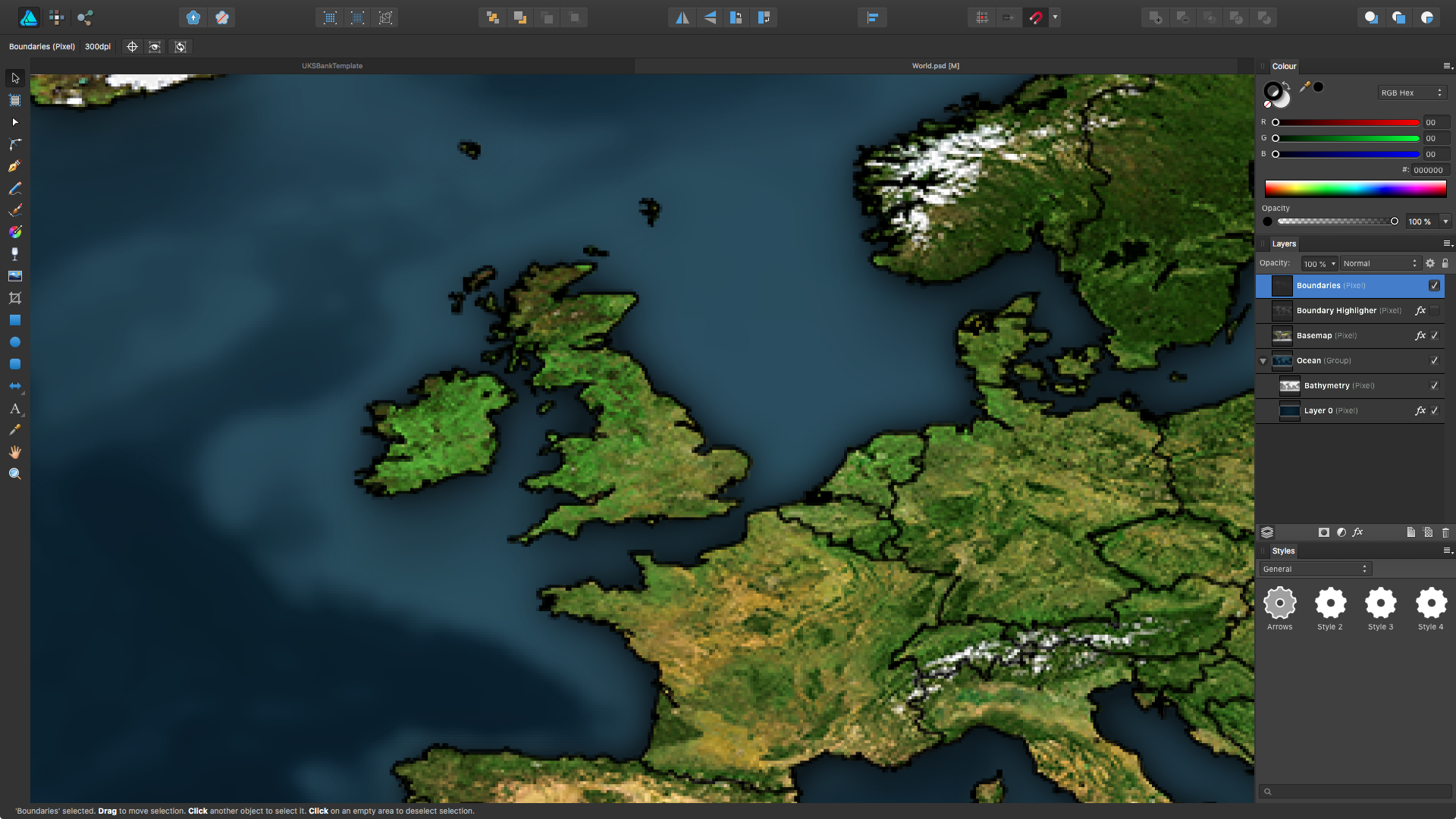
I recently brought Ultimate Map Pack: Global from metgraphics.net and upon zooming in it gets distorted. The creator of these maps says it is the lack of smart-scaling in the Affinity products.
Because of this I cannot zoom into the area I require. Is there a way round this/am I missing something?
Please help!!
-
I would like to create something like this: https://cl.ly/r2Fj but I cannot find a way to create a table in Designer.
Anyone able to help a guy out?!


Removing white background of JPEG
in Affinity on Desktop Questions (macOS and Windows)
Posted
Looking to remove the white background of this JPEG within Photo or Designer. Every-time I try it's removing the white from the deer/santa hat.
Any suggestions welcome. Thanks.