-
Posts
15 -
Joined
-
Last visited
Contact Methods
-
Website URL
www.cartagram.com
-
Facebook
mrstevenhgordon
Profile Information
-
Location
Alabama
-
Interests
Cartography and Photography
Recent Profile Visitors
The recent visitors block is disabled and is not being shown to other users.
-
 MikeTO reacted to a post in a topic:
Instant crash in MacOS and iPadOS
-
Thanks, Mike, for both testing the afdesign file and for providing the afpub and svg files. It's working well on my Mac. I'll open it on the iPad and see if a crash results. That might bring the iPad into the suspect list for this bug.
-
Thanks, Mike. Before I got your response, I was able to open the file on my Mac long enough to embed the three graphics. I closed the Mac file and opened it in the iPad and deleted the St. Michael cross.afdesign, opened that file in Designer, turned type into curves, and saved the file with a new name (St. Michael logo.afdesign). However, the app soon crashed and couldn't reopen it on iPad or Mac. Once I got your response, I renamed the Publisher file on the Mac and it soon crashed the app. Attached is the St. Michael logo.afdesign file. Hope that helps. Thank you! St Michael logo.afdesign
-
Carta started following Designer file fails to Save and Instant crash in MacOS and iPadOS
-
I started a document in Publisher 2.2 on MacOS Sonama (14.0.0) on a 2020 MacBook Pro (Intel). I continued the working on a 4th gen. iPad Pro 11" running iPadOS 17.0.2. On the iPad, I got a warning about granting permission to access a folder for a placed graphic. When I granted permission, the app crashed. Could not keep it open on iPad. On the Mac, same behavior. The file opens but as soon as an action is taken with the Resource Manager, the first thing that pops up, the app crashes. I can open Publisher using another file and it stays open so far. So I believe the file that crashed the app was corrupted. I'm uploading a .zip with both the file and a text doc containing the diagnostic report sent to Apple when the app crashes. Cartagram-CrashReport.zip
-
Lee...Thank you for your response. Good news is, that file works (and saves) perfectly now. Since my post, I've restarted my Mac several times and have upgraded to MacOS 13.0.1. BTW: the speed of saving and opening my map files (which can be large) is impressively fast with 2.0. Good job with this software release. Steve
-
Running Designer 2.0 on a MacBook Pro (Intel) in MacOS Ventura, I have one file that opens but freezes the Designer when trying to File > Save. The file was created in Designer 1.x on the same MacBook Pro. It never had any issues opening or saving until I brought it into Designer 2.0. What may be causing problems are (1) file size at 133 MB) or (2) several layers of raster brush work. The file dimensions are 11 x 17 and resolution is 300 dpi. When selecting File > Save, the progress bar displays in the Save Document dialog box--but the progress icon never moves from the left side. Eventually I Force Quit the software and restart. Does Affinity Support want to look at the file? If so, how do I get it to them?
-

Export/Retain Georeferenced PDF Metadata
Carta replied to bobwz's topic in Feedback for Affinity Designer V1 on Desktop
Thanks for commenting, Kelly. The GIS software is needed to compile data for things like streets, lakes, points-of-interest in a file that can be output as "vector" art (like svg or PDF). My workflow is to use this output directly in Affinity Designer if the file doesn't need any directly manipulation of the GIS data. More often, I must use Adobe Illustrator because it has a plug-in called Avenza MAPublisher. That allows me to select data in the Illustrator file by attriat her doesn't work with Affinity apps and I don't see that day coming anytime soon. But, what my original post suggests, is that if Designer can open a PDF from GIS software and keep its geographic information (where it's located, what map projection it uses, etc.), then mapmakers could work more in Designer and output a PDF that keeps that geographic information (a "GeoPDF"). Adobe Acrobat Reader can open and keep the geographic information that's in the original PDF. So it would be awesome if Designer could also keep the info in a PDF it opens and keep it upon export to PDF after the PDF has been modified in Designer. -
 Kelly Bellis reacted to a post in a topic:
Export/Retain Georeferenced PDF Metadata
-

Export/Retain Georeferenced PDF Metadata
Carta replied to bobwz's topic in Feedback for Affinity Designer V1 on Desktop
Another possible workflow is to use Acrobat DC Pro (a paid app that's part of the Adobe Creative Cloud suite of software). According to Adobe, a GeoPDF, among several other geospatial file formats, can be directly imported. It will import shapefile data directly. See their webpage. I'm not an Acrobat subscriber other than the free Acrobat DC Reader. I'm speculating how this would work: 1. In QGIS, export two PDFs -- one for the full file and the other just containing a background or neatline 2. Edit the full export in Designer and export from Designer as a PDF 2. Open the QGIS-exported file with the background or neatline in Acrobat DC Pro 3. Now use Acrobat's combine command to merge them into a single PDF -- the idea here is that the first file opened in Acrobat would be the master and so retain its geo-referencing. The merged Designer-generated file would be combined without creating a new, non-geo-referenced PDF. Anyone able to test this? -
Carta changed their profile photo
-

Export/Retain Georeferenced PDF Metadata
Carta replied to bobwz's topic in Feedback for Affinity Designer V1 on Desktop
Bobwz's request is spot on. From my experience, there are two really useful applications to his request: 1. A PDF can be imported into a GIS app like QGIS or ArcInfo. That completes a round-trip journey where a map is developed in GIS software, exported and edited in Designer, then imported back into the GIS software. Why the round-trip? Because while GIS software provides adequate graphics control of a map, Designer makes it sparkle. Designer's type tools alone are enough to elevate map quality by a large margin. Importing a visually enhanced Designer map into GIS software where it may be shared or used in mapping operations gives added value to the map. 2. A geo-referenced (or "geospatial") PDF can be uploaded to the Avenza Map Store. This store offers mapmakers a way of distributing maps. It serves mapmakers like the Kindle Store serves authors. The map store has nearly a million submissions. For more information, see www.avenzamaps.com Preserving the geo-referencing for a PDF exported from GIS software would prove a great asset for mapmakers using Affinity products. -
Oh yeah, I meant Publisher (not Photo). Thanks for notifying me about the abbreviation. I'm preaching to the choir here but Publisher has been a life-saver for me. It's actually increased the range of projects I handle. Before, with Adobe, I rarely used InDesign because layout projects were few and far between. So no sense in adding that to my subscription. Big fan here of Affinity apps.
-
 R C-R reacted to a post in a topic:
Text Path now showing black-stroked path under text
-
Update... I created a new document in AD and drew a curved path with the Pen tool. Then, selecting the Artistic Text tool, I clicked on the path and type some words. When I deselected the resulting Text Path, there was not stroke for the path. So it appears that what all of you call the default behavior is still default. I'm guessing that having build much of the map in AP, before copying and pasting its layers in AD, I may have carried over something in the file (instructions, styling attributes, etc.) that overrode the default for text paths. I'll make sure next time I start stuff in AD when it's more appropriate to create the item in AD. Thanks to all who've contributed to this thread!
-
pbasdf...you did it. That worked great! Thank you so much. I'm not sure if there's a bug in the AD. But if Callum (Moderator) requests a file, I'll send one. And also thanks for making me aware of the Text Frame tool. Didn't know it was there...(yeah, I don't thoroughly read the documentation even though for years I wrote documentation for Adobe Illustrator). Steve | Cartagram
-
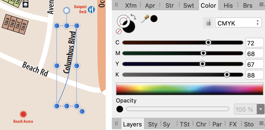
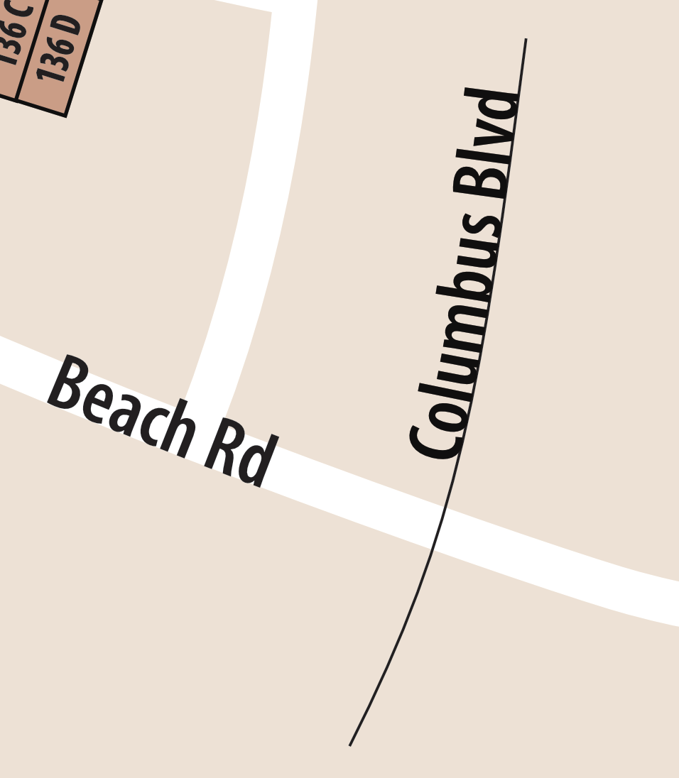
I've tried two ways of creating text paths (for adding curved labels on maps). One method was to create a text frame and convert it to a Text Path (Layer > Convert to Text Path) and the other was to draw a path and then click on it with the Artistic Text tool. In both cases, the text path includes a black stroke below the text. Controls for changing stroke values, such as found in the Appearance and Stroke panels, has no effect on it. What am I missing? BTW: my work around is to create a text path in Publisher and then copy-paste in Designer. Not ideal but I'm able to finish this project. Thanks!
-
I'm working in Publisher on a Mac to create a multi-advertisement piece that will be printed. One advertiser sent a PDF for their ad and it brings up a Preflight error: "Placed PDF Version (PDF_1.7) is not compatible with the PDF export version..." Their ad uses fonts not available to me. And using the Fix option substitutes fonts, changing the look of the ad. My question is, should I leave it as-is or should I Rasterize it? When I export the page of ads with Publisher's PDF (Press Ready) option, and open the exported PDF in Acrobat, all looks well. Do I trust that the ads will look the same as I see it when the file goes to the printing company? (I'm not sure how Publisher handles a PDF without fonts present on my system.) The other option is to rasterize this ad in Publisher. When exported to PDF, at 200% zoom in Acrobat, the type still looks sharp (non-pixelated). Any best-practices advice would be really appreciated!


